The Spatial Humanities Working Group (SHWG) is a group of scholars at Binghamton University who seek to foster and support spatial humanities digital scholarship on campus by workshopping papers, teaching digital tools and methods, and engaging critically with existing scholarship in this emerging field. The group is informal and open to faculty and graduate students across a diversity of fields within (and beyond) the Humanities and Social Sciences.
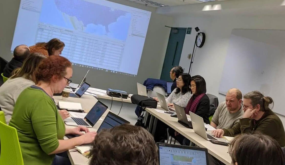
Current Members of the SHWG
The SHWG kicked-off its first meeting in Fall 2019 and the group includes faculty, librarians, professional staff, and graduate students across departments. Our members' skills and experience levels vary with our knowledge of spatial humanities. Some members are already developing projects and curriculum related to spatial humanities while others are just beginning their journeys into learning about these types of projects. Learn more about those who are part of the SHWG by visiting our current SHWG member profiles. If you are interested in joining the SHWG, reach out to Brad Skopyk.
Upcoming Meetings and Events
Introduction to Mapping Using R and Leaflet
Led by Melissa Haller (Digital and Data Studies)
Event Type: Workshop
When: 3 - 5 p.m. Wednesday, September 20
Where: LN 2200 Alpern Room (Dean's Conference Room)
Description: Although GIS software is commonly used to produce maps, programming languages like
R are rapidly expanding their geospatial capabilities. This hands-on workshop will
cover some of the basics of producing maps using R statistical software and the Leaflet
package to make dynamic, interactive maps. Dynamic maps allow us to view multiple
geographic variables simultaneously, to explore patterns with data in an interactive
way, and to visualize spatial changes over time, and have many applications in the
Humanities and related fields. This workshop is designed for any skill level, and
no prior programming experience is necessary.
Custom Crowdsourcing App for Health in Premodern Mexico
Led by Brad Skopyk (History) and David Mixter (Environmental Studies, Anthropology)
Event Type: Data Science TAE, Data Salon
When: Noon - 1 p.m. Friday, September 29
Where: Academic A (AA) 340
Description:In this presentation, we demo and explain the digital infrastructure for a new historical crowdsourcing application of geo-located health events for Mexico before the twentieth century. The crowdsourced database aims to facilitate international collaboration on a data-intensive health-related project and is an important teaching resource for undergraduate classrooms. It uses an Angular frontend with Spring Boot microservices connected to a postgresql database, which subsequently feeds a website for data visualization in maps and graphics. In the future, we aim to make the database freely available to researchers for purposes of analysis, download, and output of custom cartography and other visualizations. The project is in the initial development phase in which we continue to question the underlying data design and web implementation. We hope to open a conversation with data scientists about possible pathways forward.
Visualizing Quantities: Mapping an Ottoman Survey from the 16th century
Led by Yunus Tortamis (Department of History)
Event Type: Presentation
When: 3 - 5 p.m. Wednesday, October 11
Where: pilot Digital Scholarship Center (SL 209)
Description: This project aims to map and visualize quantitative data found in the
Ottoman survey of Kadirli province. Created in 1563, this survey lists major population
centers and clans with their tax obligations. The surveyed region of Kadirli straddles
fertile and flat fields of Çukurova region and verdant pastures of the Taurus mountains,
thereby giving a unique opportunity to study the interactions between nomadic and
sedentary groups. This survey also stands apart from its counterparts in specifying
different locations of marginal farming, winter and summer pastures. The goal of this
project is to present copious volumes of numeric data more effectively and to investigate
factors relevant to different modes of living.
Late Ottoman Lighthouses: Making of a Maritime Infrastructure
Led by Esra Nalbant (Department of Art History)
Event Type: Presentation
When: 3 -5 p.m. Wednesday, November 8
Where: pilot Digital Scholarship Center (SL-209)
Description: My project looks at the development of the navigation safety infrastructure web and its relationship with the greater maritime infrastructure network in the second half of the nineteenth century. In the Atlas of Coulier, designed for the navigators and published in 1844, twenty-four lighthouses existed on the shores of the Ottoman Empire. This number was quadrupled in 1879, thirty-five years later, on the coastline of the Ottoman Empire. I aim to understand the complex relations of the lighthouse network with more extensive interconnected maritime networks on a global scale. To this end I want to map out the lighthouse construction patterns with the help of various French and Ottoman Turkish sources in which the construction dates and locations of the said lighthouses were listed.
Workshop on Creating Distributive Flow Maps
Led by Yunus Tortamis and Brad Skopyk with support from many members of SHWG.
Event Type: Workshop
When: 3 -5 p.m.Wednesday, February 28
Where: pilot Digital Scholarship Center (SL-209)
Description: This workshop will guide participants through the whys and hows to create distributive flow maps such as seen in the instructional materials. Distributive flow maps show the flow from a point of origin to multiple destinations, visualized with arrows and varied line thickness to represent the quantity or intensity of the distributed entity. We will use Yunus Tortamis's data on the 16th-c Ottoman nomad seasonal migrations. All faculty and grad students are welcome to attend. No experience necessary! Access materials here.
Ottoman Lighthouses: A Conversation about Mapping Historical Sources
Led by Esra Nalbant, John Cheng, Ruth Carpenter, Brad Skopyk and members of the Nalbant Working Group
Event Type: Guided Conversation
When: 3 -4:30 p.m. Wednesday, April 10
Where: pilot Digital Scholarship Center (SL-209)
Description: This conversation centers upon the methods, workflows, and challenges to create a modern GIS from historical textual and cartographic materials. This is the culminating step of Esra Nalbant's Ottoman Lighthouses SHWG project. The conversation will be centered upon specific methodological challenges, such as the conversion of historical map coordinates into modern geographic coordinate systems, georeferencing and digitizing historical maps, designing databases to merge and compare various textual and graphic sources, calculating light visual ranges for lighthouses, and visualizing the rendered GIS data. A StoryMap has been created to help guide the conversation.
Check back as we will update events as requests come through. If you are not on our mailing list and are interested in attending any of the above sessions, reach out to Brad Skopyk.
Materials from Past Meetings
Our past meetings and events have included project discussions, researching and reviewing public projects developed at other institutions, and workshops on platforms and software available for spatial humanities projects.
Event Archives
Additional content:
- April 2021 - storymap containing resources and a recording of our Omeka S webinar
- March 2021 - recording of Spreadsheets for Humanities Scholars session
- December 2020 - storymap containing resources and a recording of our Omeka Classic + Neatline webinar
- February 2023 - Starting a Digital Project Storymap with best practices and examples of where to start when planning a digital project of any kind
- May 2023 - Designing Databases for Humanities Projects Storymap best practices and guidance for getting started with database design
- September 2023 - Mapping in R and Leaflet requires downloading R and R Studio. For more tutorials on mapping in R check out Melissa Haller's RPub Page.